
|
*Please note- This site search does not include the Vic. & Tas. BMD's, Lots o' Links & Worth a Look Books
|
JOHN ROCQUE
SURVEYOR, CARTOGRAPHER
ca.1704-1762
John Rocque was born circa 1704 in France, one of four children to Huguenot parents who settled in Geneva after fleeing France around 1709. John Rocque emigrated to London before 1734 in company with his brother Bartholomew, where much of his early career involved drawing plans of aristocratic gardens.
Later, Rocque became interested in cartography, his survey of London was planned with George Vertue & surveyed from 1738 & published in 24 sheets in 1746. It was outstanding as a plan of the capital in the 18th century. The project to map London, was first agreed upon in 1737 & the survey began almost immediately. During the next 9 years, Rocque divided his time between the London project and a series of maps & plans of provincial towns including Exeter, Shrewsbury & Bristol.
The map of London was financed by subscription & the price was three guineas; One to be paid down at the time of subscribing, and two more on the delivery of the work. Two hundred & six individuals bought a copy of the map at this price, the list headed by Frederick, Prince of Wales, who later appointed Rocque as the official royal cartographer. His six county surveys, were- Armagh, Shropshire, Middlesex, Dublin 1760, Berkshire 1761 and Surrey, but projected surveys of Kent, Oxfordshire, and Buckinghamshire did not eventuate. His distinctive contribution was to apply the conventions of estate and garden plans to county maps. His estate surveys included the Barnard lands in Shropshire (1746–8) and the earl of Kildare's estates (1755–60).
Rocque lived in Great Windmill Street on the edge of the French quarter in Soho until 1743, in Piccadilly opposite Green Park until 1749, and in Whitehall until a fire in 1750 destroyed his possessions & re-established his business in 1751 in the Strand at the centre of the London map trade.
From 1751 Rocque styled himself chorographer or topographer to the prince of Wales and from 1760 to the king. His modest means came chiefly from printselling, which was common with many of his trade. His cartographic projects were often financially precarious and consequently dragged on.
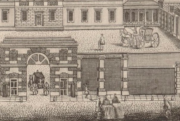
In 1753, Rocque briefly contemplated retirement, passing on his business as a going concern to a nephew, then based in Mannheim. When his nephew didn't show any interest, Rocque continued with renewed vitality, spending six of the last nine years of his life based in Ireland.Rocque's Dublin map, creates the impression of seeing Dublin as if from the air, while simultaneously maintaining the highest standards of planimetric accuracy. So impressed was the king, George II, that he ordered the map to be hung on his own wall. The detail was immense in his Dublin map, piles of timber appear in timber-yards, headstones are shown in graveyards, bollards are shown along streets, even individual trees are represented.
Rocque’s Irish work between 1754 and 1760, included a series of c.170 manuscript estate maps for the earl of Kildare, and a range of commercially-driven projects that resulted in finely engraved and printed surveys of the cities of Dublin, Cork and Kilkenny, a town map of Thurles, county maps of Dublin and Armagh, and a general map (derived mainly from already existing sources) of Ireland.
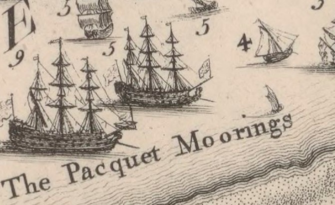
His Survey of the City & Suburbs of Dublin, commenced in 1754 & was published in four sheets, two years later. Beautifully engraved and surveyed with great accuracy, the map was drawn to a similar scale as his London masterpiece, two hundred feet to an inch (1:2400) & portrayed all public buildings, dwelling houses, ware houses, stables, etc., various buildings associated with manufacturing & community activity are identified by name. Fine engraving by Rocque’s principal associate, Andrew Dury, leaves an unforgettable impression.
The French school of Surveyors (founded by Rocque) earned an outstanding reputation in Irish cartography.
Rocque died on January 27th 1762. His widow, Mary Ann, carried on the business with the assistance of her late husband's associates.
Reference
http://www.oxforddnb.com/view/article/37907
Later, Rocque became interested in cartography, his survey of London was planned with George Vertue & surveyed from 1738 & published in 24 sheets in 1746. It was outstanding as a plan of the capital in the 18th century. The project to map London, was first agreed upon in 1737 & the survey began almost immediately. During the next 9 years, Rocque divided his time between the London project and a series of maps & plans of provincial towns including Exeter, Shrewsbury & Bristol.
The map of London was financed by subscription & the price was three guineas; One to be paid down at the time of subscribing, and two more on the delivery of the work. Two hundred & six individuals bought a copy of the map at this price, the list headed by Frederick, Prince of Wales, who later appointed Rocque as the official royal cartographer. His six county surveys, were- Armagh, Shropshire, Middlesex, Dublin 1760, Berkshire 1761 and Surrey, but projected surveys of Kent, Oxfordshire, and Buckinghamshire did not eventuate. His distinctive contribution was to apply the conventions of estate and garden plans to county maps. His estate surveys included the Barnard lands in Shropshire (1746–8) and the earl of Kildare's estates (1755–60).
Rocque lived in Great Windmill Street on the edge of the French quarter in Soho until 1743, in Piccadilly opposite Green Park until 1749, and in Whitehall until a fire in 1750 destroyed his possessions & re-established his business in 1751 in the Strand at the centre of the London map trade.
From 1751 Rocque styled himself chorographer or topographer to the prince of Wales and from 1760 to the king. His modest means came chiefly from printselling, which was common with many of his trade. His cartographic projects were often financially precarious and consequently dragged on.
In 1753, Rocque briefly contemplated retirement, passing on his business as a going concern to a nephew, then based in Mannheim. When his nephew didn't show any interest, Rocque continued with renewed vitality, spending six of the last nine years of his life based in Ireland.Rocque's Dublin map, creates the impression of seeing Dublin as if from the air, while simultaneously maintaining the highest standards of planimetric accuracy. So impressed was the king, George II, that he ordered the map to be hung on his own wall. The detail was immense in his Dublin map, piles of timber appear in timber-yards, headstones are shown in graveyards, bollards are shown along streets, even individual trees are represented.
Rocque’s Irish work between 1754 and 1760, included a series of c.170 manuscript estate maps for the earl of Kildare, and a range of commercially-driven projects that resulted in finely engraved and printed surveys of the cities of Dublin, Cork and Kilkenny, a town map of Thurles, county maps of Dublin and Armagh, and a general map (derived mainly from already existing sources) of Ireland.
His Survey of the City & Suburbs of Dublin, commenced in 1754 & was published in four sheets, two years later. Beautifully engraved and surveyed with great accuracy, the map was drawn to a similar scale as his London masterpiece, two hundred feet to an inch (1:2400) & portrayed all public buildings, dwelling houses, ware houses, stables, etc., various buildings associated with manufacturing & community activity are identified by name. Fine engraving by Rocque’s principal associate, Andrew Dury, leaves an unforgettable impression.
The French school of Surveyors (founded by Rocque) earned an outstanding reputation in Irish cartography.
Rocque died on January 27th 1762. His widow, Mary Ann, carried on the business with the assistance of her late husband's associates.
Reference
http://www.oxforddnb.com/view/article/37907
1. Rocque's Surveys
2. The Detail
3. Rocque's London, Westminster & Southwark
4. Four colour maps
5. Engraved or Etched copper maps
6. Surveyors & Cartographers
7. Equipment
8. Cartouches
9. Australian Cartography & Maps
10 Map Search
11 Huguenots
2. The Detail
3. Rocque's London, Westminster & Southwark
4. Four colour maps
5. Engraved or Etched copper maps
6. Surveyors & Cartographers
7. Equipment
8. Cartouches
9. Australian Cartography & Maps
10 Map Search
11 Huguenots
Rocque's Surveys
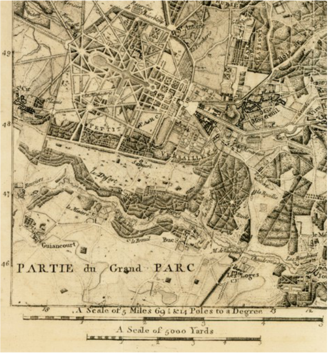
Rocque could count among his achievements, maps of London, Paris, Berlin and Rome. In Britain, his many projects included plans of great gardens, several county and provincial city maps and a great, highly innovative, survey of London which resulted in a 16-sheet map of London & its immediate hinterland and an immense 24-sheet map of the city itself, laid out at a very large scale close to 200 feet to an inch.
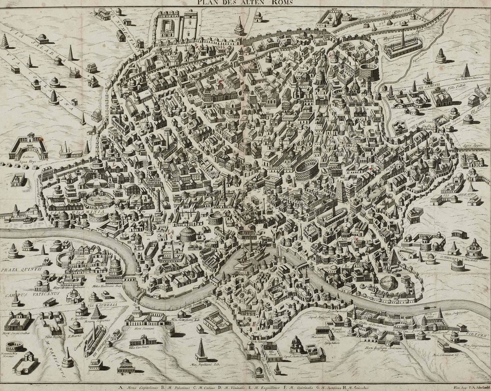
Map of Rome
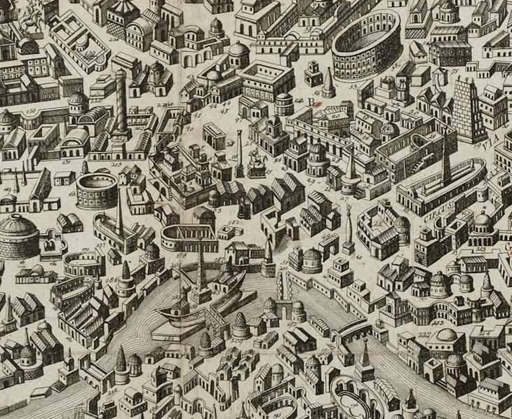
Enlarged Section of Rome Map
Section of the Map of Paris
Section of the Map of Berlin
Rocque's Paris Map
https://www.raremaps.com/gallery/detail/1754RB/A_Plan_of_Paris_andc_reducd
Rocque's Berlin Map
http://gallica.bnf.fr/ark:/12148/btv1b530396138
Rocque's Rome Map
https://drawingfromthearchives.files.wordpress.com/2014/10/1792
https://www.raremaps.com/gallery/detail/1754RB/A_Plan_of_Paris_andc_reducd
Rocque's Berlin Map
http://gallica.bnf.fr/ark:/12148/btv1b530396138
Rocque's Rome Map
https://drawingfromthearchives.files.wordpress.com/2014/10/1792
The need for land surveys grew from disputes over land ownership, establishing of rents according to the exact acreage of a property & for planning & construction.
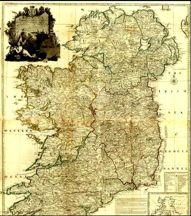
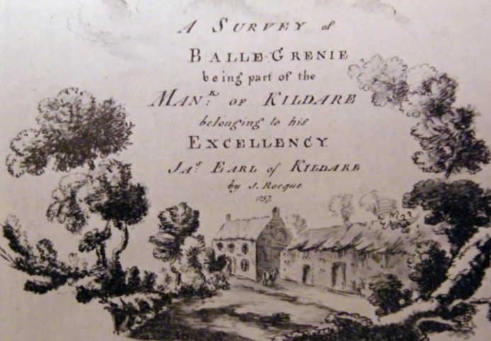
Rocque’s Exact Survey of the City and Suburbs of Dublin

Bottom Section of Dublin Map.
Includes a Miniature of John Speed's 1610 Map of Dublin (Bottom Right Corner)
Includes a Miniature of John Speed's 1610 Map of Dublin (Bottom Right Corner)
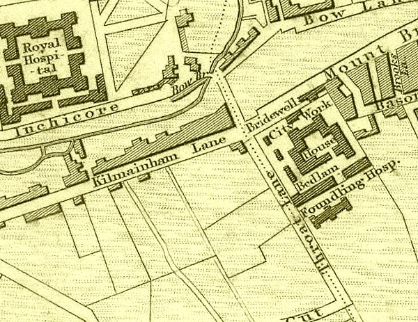
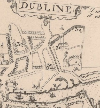
The city basin, built in 1724 to sustain the expanding city, is shown close to bridewell & the city workhouse with its great hall and dedicated ‘bedlam’. Close to the city workhouse, the ominously-named ‘Cut Throat Lane’, prominent on the city basin page, and on its equally ominous extension ‘Murdering Lane’. The Bason, or Basin was a reservoir supplying this area of the city & the ever growing number of breweries and distilleries-with water. It was also a place for local residents to escape the confines of the city’s streets.
http://gallica.bnf.fr/ark:/12148/btv1b53057253b
http://gallica.bnf.fr/ark:/12148/btv1b53057253b
|
Cut-throat Lane and Murdering Lane were two adjoining streets in Mount-Brown. The name Cut-throat Lane, which was in existence as far back as 1488, was changed to Roundhead Row in 1876 and Murdering Lane was changed to Cromwell's Quarter. We can only imagine why they had those names originally?.
|
John Rocque's brother Bartholomew, was a horticulturist and landscape gardener in Walham Green, Fulham.
The Detail


|
|
Rocque's Miniature of Speed's Map

John Speed's Dublin 1610
Detail showing a figure hanging from the gallows.
Robert Newcomen, Map of the parish of Clondalkin (1656). |
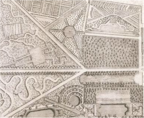
Detail of the Garden in the Map of Chiswick & View of Garden houses
1736, John Rocque |
|
LAND SURVEYING IN EIGHTEENTH AND EARLY NINETEENTH-CENTURY DUBLIN By Finnian O’Cionnaith National University of Ireland Maynooth http://eprints.maynoothuniversity.ie/2568/1/ |

|

The first Essex Bridge, Joseph Tudor, Customs House quay and Essex Bridge looking south
(London, 1753), reproduced in Colm Lennon, Dublin part 2, 1610 to 1756 (Irish Historic Towns Atlas) 
IRISH HISTORIC TOWNS ATLAS-DUBLIN
Dublin part 1 to 1610 http://www.logainm.ie/Eolas/Data/IHTA/dublin-1.pdf Dublin part 2 1610-1756 http://www.logainm.ie/Eolas/Data/IHTA/dublin-2.pdf Dublin part 3 1756-1847 http://www.logainm.ie/Eolas/Data/IHTA/dublin-3.pdf |

Example of mixed map design with a rococo cartouche but with a reference table along more traditional style guidelines. Thomas Reading, Map of the Liberty of Christ Church (1764). Reproduced in H.B. Clarke, Dublin part 1, to 1610 (Irish Historic Towns Atlas, no. 11, Dublin, 2002).
|
Roger Kendrick was the verger of St. Patrick’s Cathedral and held the office of Dublin city surveyor from 1735 to 1764. Kendrick and Rocque had a clash of interest which was fought out in the newspapers, over the mapping of Dublin.
Rocque's London,
Westminster & Southwark
Westminster & Southwark
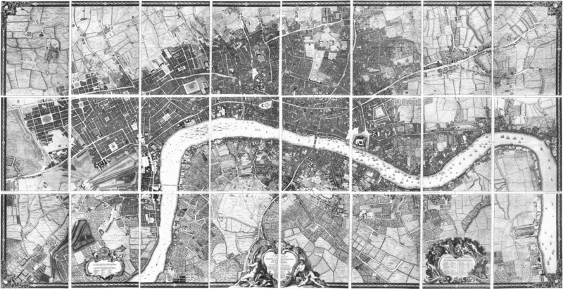
JOHN ROCQUE LONDON, WESTMINSTER AND SOUTHWARK (First edition) 1746
http://www.motco.com/map/81002/
http://www.motco.com/map/81002/
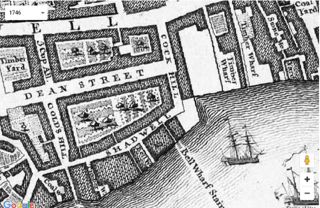
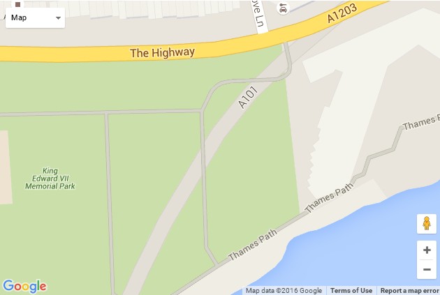
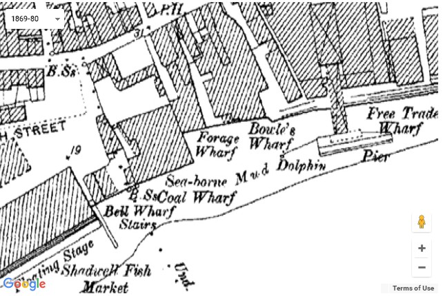
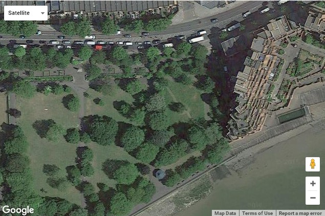
Compare the same area of London, in 4 different ways-
1746, 1869, Google maps today, Satellite view today.
http://www.locatinglondon.org/index.html
1746, 1869, Google maps today, Satellite view today.
http://www.locatinglondon.org/index.html
|
|
Tutorials
There are Three short 3 minute tutorials (no sound) and one 28 minute tutorial (with sound), showing you how to get the most out of searching the London area. Building on a fully GIS compliant version of John Rocque's 1746 map of London, this site allows you to relate an eighteenth-century representation of the metropolis to the first accurate OS map of London (1869-80), and to a modern Google Maps environment.
https://vimeo.com/album/1770693/video/33351749
|
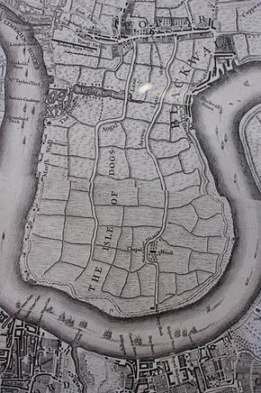
Isle of Dogs as shown in John Rocque's map of London 1747
The Isle of Dogs is an area in the East End of London that is bounded on three sides (east, south and west) by one of the largest meanders in the River Thames. Brewer's 1898 Dictionary of Phrase and Fable attributes the name: "So called from being the receptacle of the greyhounds of Edward III, but there are several other explainations as well as this one. The Isle of Dogs was the title of an early play by Ben Jonson and Thomas Nashe, briefly performed in 1597 and then thoroughly suppressed as slanderous. In modern times the Isle of Dogs has provided locations for many blockbuster films, including the opening scenes of the James Bond film The World Is Not Enough, and more recently Batman Begins, The Constant Gardener, Harry Potter and the Order of the Phoenix, and Love Actually. https://en.wikipedia.org/wiki/Isle_of_Dogs |
|
Person Name Search- London lives
http://www.londonlives.org/formPersName.jsp Alternative Designs for London’s Iconic Tower Bridge
http://londontopia.net/site-news/featured/gallery-alternative |
|
Read- The Diary of Samuel Pepys
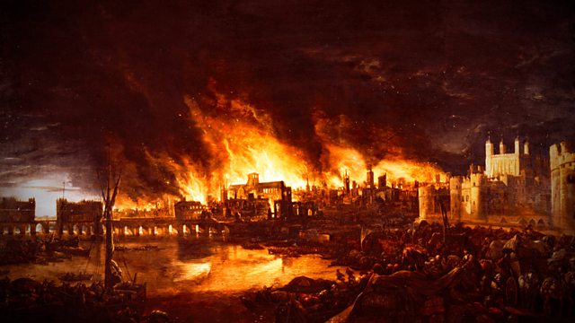
http://www.pepys.info/1660/1660jan.html http://www.gutenberg.org/ebooks/4200 Why Did The Great Fire Of London Happen?
The Great Fire of London began at approximately 1am on Sunday 2nd September, 1666. That summer had been exceptionally dry and London was in the midst of a drought. Buildings, made of timber covered in pitch and tightly packed together, had dried out in the heat. In effect, by Sunday 2nd Sept. London was a giant tinder-box, vulnerable to even the smallest source of ignition. …old paper buildings and the most combustible matter of Tarr, Pitch, Hemp, Rosen, and Flax which was all layd up thereabouts. (An unknown correspondent writing to Lord Conway, September, 1666, describing the buildings along the wharves of London) |
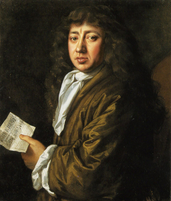
Samuel Pepys
Samuel Pepys (23 February 1633 – 26 May 1703), was an English naval administrator and Member of Parliament who is most famous for the diary he kept for a decade while still a relatively young man. Although Pepys had no maritime experience, he rose by patronage, hard work, and his talent for administration to be the Chief Secretary to the Admiralty under both King Charles II and King James II. His influence and reforms at the Admiralty were important in the early professionalisation of the Royal Navy. The detailed private diary Pepys kept from 1660 until 1669 was first published in the 19th century and is one of the most important primary sources for the English Restoration period. It provides a combination of personal revelation and eyewitness accounts of great events, such as the Great Plague of London, the Second Dutch War, and the Great Fire of London.(wiki) 
Samuel Pepys & The Great Fire Of London 1666
https://comestepbackintime.wordpress.com/2014/11/01/ |
Four Colour Maps
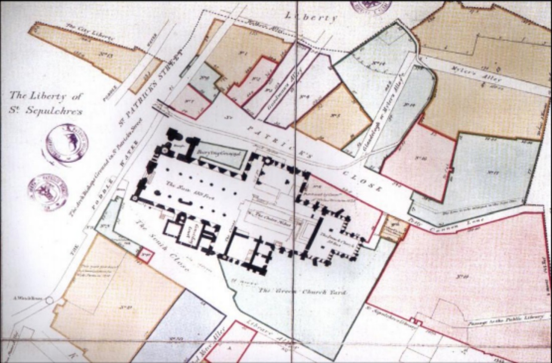
Colour was used to highlight land ownership and leases. Roger Kendrick
Map of the Liberty of St. Pat’s Cathedral, 1754
Map of the Liberty of St. Pat’s Cathedral, 1754
Realistic colour scheme applied to map features (John Rocque)
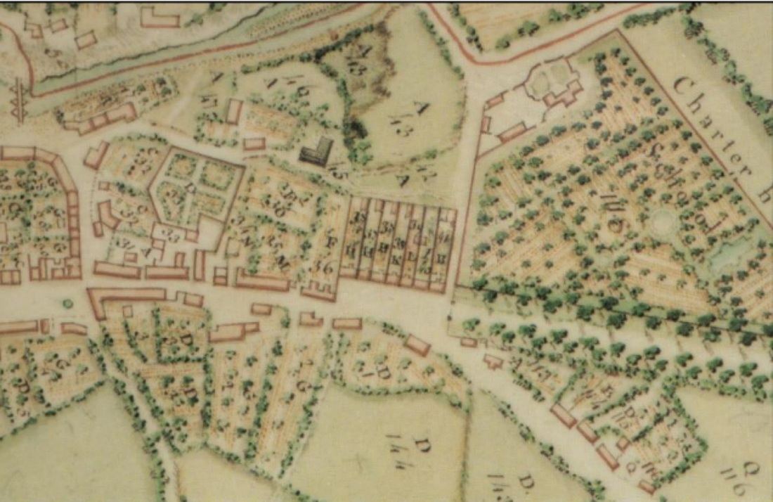
A survey of the town and lands of Maynooth, 1757
Reproduced in Arnold Horner, Maynooth (Irish Historic Towns Atlas)
A survey of the town and lands of Maynooth, 1757
Reproduced in Arnold Horner, Maynooth (Irish Historic Towns Atlas)
|
When the original black & white print had been produced, the print would have been realigned and the coloured sections would each be super-imposed onto the print.

|
Engraved or Etched
Copper Maps
Copper Maps

The preparation of copper for engraving
The decision as to whether a map in eighteenth-century Dublin should remain in hand drawn manuscript form, or be engraved or etched into copper for mass production was dependent on several factors, including the scale, popular demand & information it contained. Copper plate printing was expensive, time consuming, requiring skilled craftsmen. Both John Rocque and Roger Kendrick felt that there was enough evidence to justify mass production of their maps of Dublin using copper plate printing. Rocque had over three hundred subscriptions before his map had been created, which helped finance the costs of engraving and printing
After the map had been transferred onto copper plate
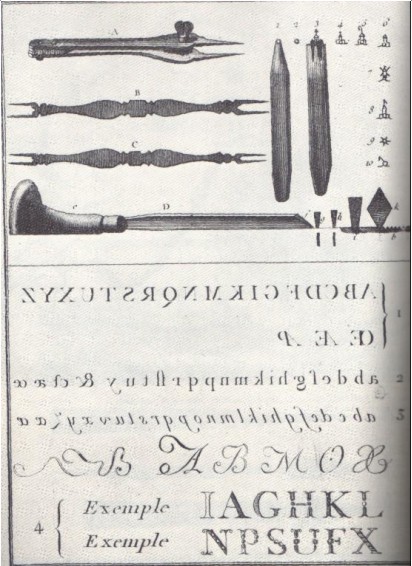
two main techniques were utilised for copper plate map production, etching and engraving. Etching, the less common of the two techniques in eighteenth-century Ireland, required the scarring of the copper plate with acid to produce a shading effect and was more to add terrain or decorative effect to maps rather than main cartographic detail. Engraving was the most common technique in use at thetime to transfer maps onto copper plate for printing. Instruments known as a burins, were used to indent the copper plate, by running it along the cartographic detail of the transferred map.
two main techniques were utilised for copper plate map production, etching and engraving. Etching, the less common of the two techniques in eighteenth-century Ireland, required the scarring of the copper plate with acid to produce a shading effect and was more to add terrain or decorative effect to maps rather than main cartographic detail. Engraving was the most common technique in use at thetime to transfer maps onto copper plate for printing. Instruments known as a burins, were used to indent the copper plate, by running it along the cartographic detail of the transferred map.

|
|
|
Burins used in eighteenth century copper plate engraving, Denis Diderot
|
Letter Punches used in copper plate printing
Denis Diderot |
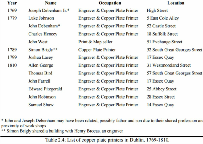
Dublin Engravers & Copper Plate Printers 1769-1810
|
The Historic Copper Mines of West Cork
7:59 |
From Paper to Copper: The Engraver's Process
7:15 |
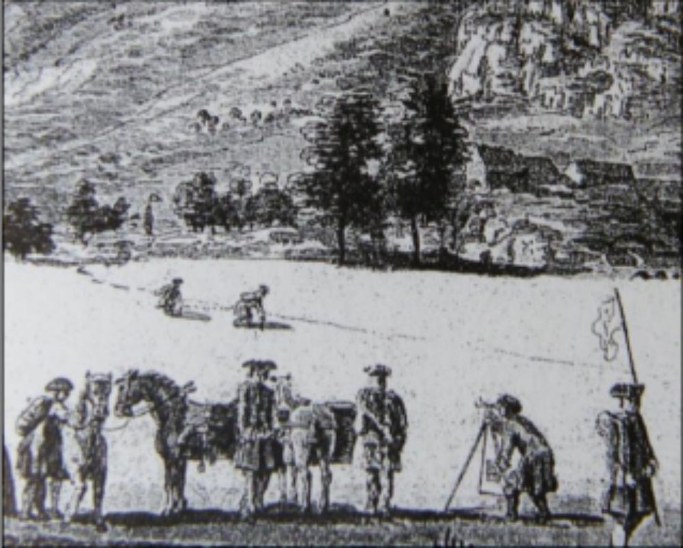
Surveyors & Cartographers
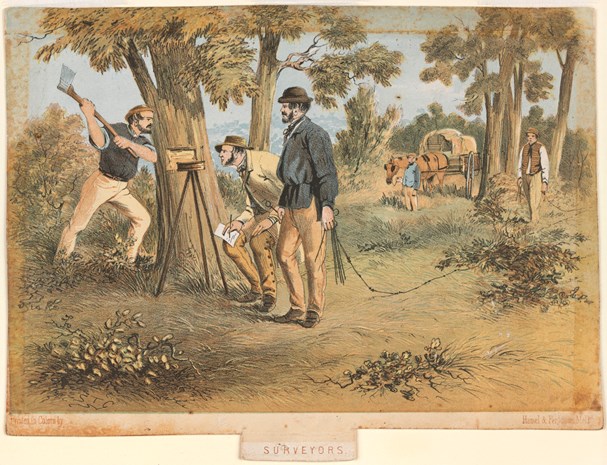
The late eighteenth century saw a massive increase in surveyor numbers
in Britain and Ireland.
in Britain and Ireland.

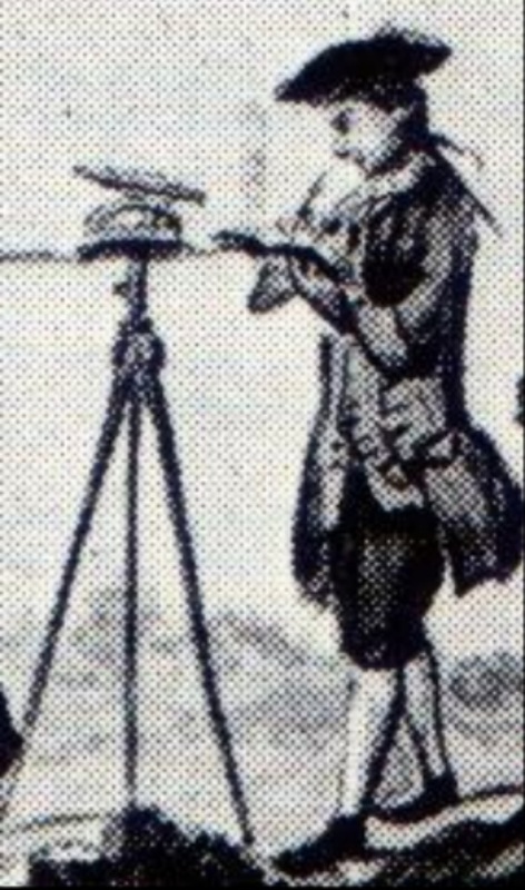
Military surveyors at work in Scotland
by Paul Sandby c.1750 Subscriptions
Securing funding for a major survey project was the first step towards completing a finished commercial product. One favourite funding method used in Dublin was subscription: the surveyor would advertise the proposed mapping project requesting that interested parties should pay approximately half the total cost of the proposed final map as a deposit, thus enabling the surveyor to obtain funds to begin the work. |
The military
was a relatively large supplier of surveyors to the Irish industry from the sixteenth century onwards William Wilson’s directory
was a business listing and was published annually from 1751 to 1837. Builders, surveyors and engineers are few and far between before the 1760s however this does not mean that they were not operating in the city at the time, simply that they had not chosen to advertise with Wilson. Wilson’s 1820 Dublin Directory http://www.from-ireland.net/wilsons-1820-dublin A TRIBUTE TO SURVEYORS / EXPLORERS OF THE 19TH CENTURY AUSTRALIA by Graham TWEEDIE
http://www.fig.net/resources/proceedings/fig_proce |
|
Dublin Surveyors 1679-1857 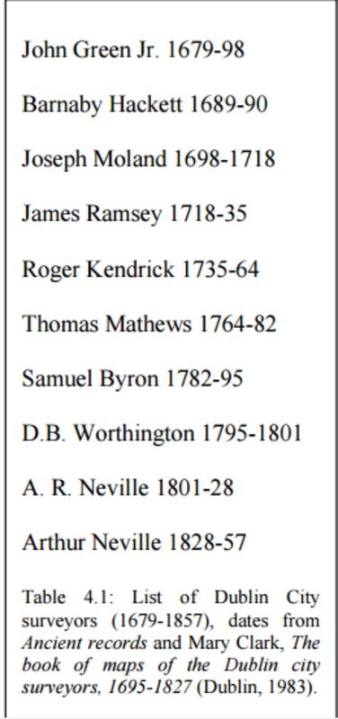
|
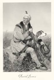
Daniel Boone - (1734-1820) Folklore Hero. Worked as a Surveyor and in 1783 became Deputy County Surveyor for Lincoln County in Kentucky.
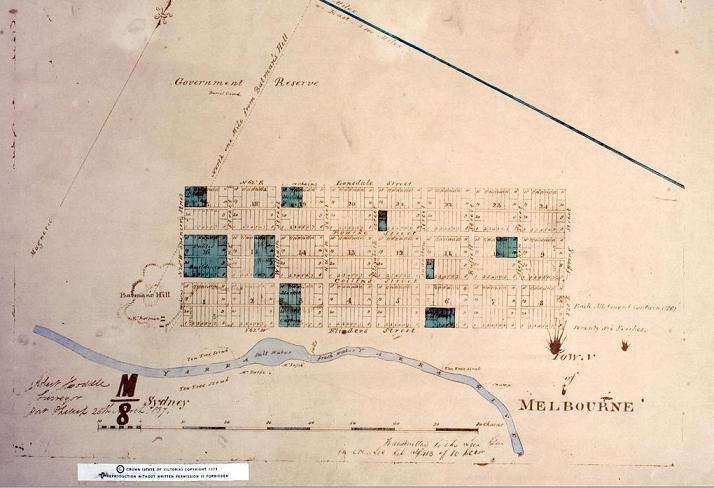
Robert Hoddle (1794 – 1881) was a surveyor of Port Phillip District (later known as Victoria) in the 1830s, and the creator of the Hoddle Grid, the system upon which inner city Melbourne is based.
|
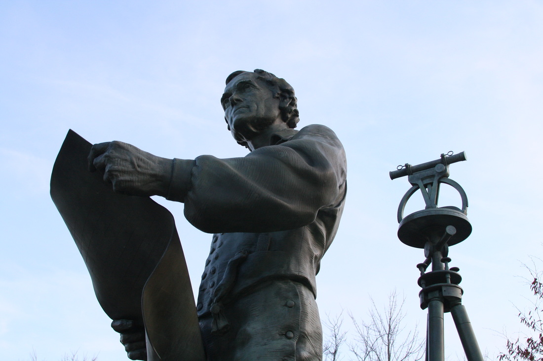
Statue of Jefferson surveying a site for the University of Virginia
Thomas Jefferson - (1743-1826) was appointed Surveyor for Abemarle County in Virginia. His Father was also a surveyor. |
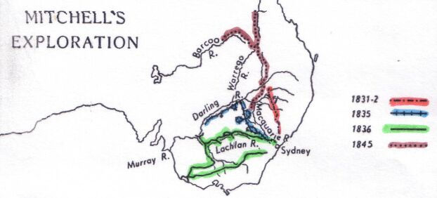
Major Thomas Livingstone Mitchell
(1792-1855) was an explorer and a surveyor. He was Surveyor-General of the colony of Australia. |
|
John Speed 1552-1629, Cartographer.
From 1606-1608 Speed surveyed approx. 26 towns and cities in England. His work officially sanctioned, a reproduction of one of his official passes was copied into the precedent book kept by the town clerk of Warwick, 17 June 1607 http://www.mapforum.com/02/speed.htm |
|
|
|
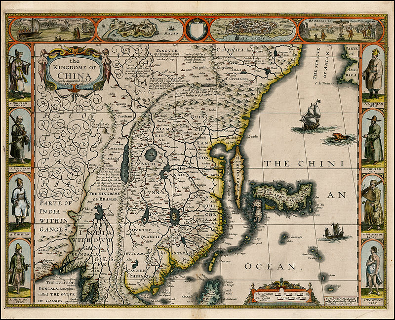
The Kingdome of China, 1626 John Speed
|
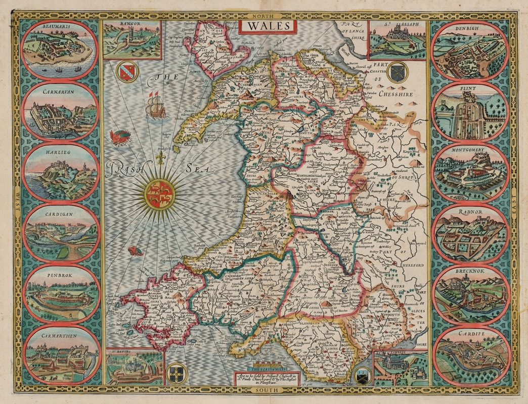
Wales, 1610 John Speed
|
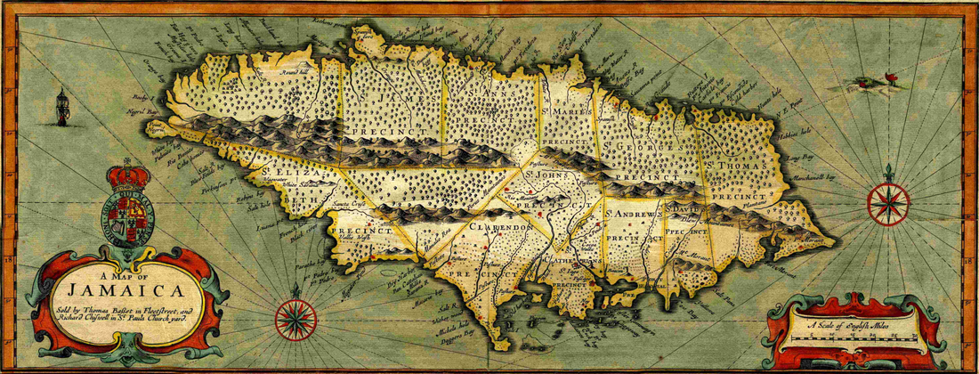
Jamaica, 1676 John Speed

London to Bristol, John Ogilby
John Ogilby (1600-1676)
was an enterprising Mapmaker and Entrepreneur. JOHN OGILBY'S BRITANNIA, 1675 http://www.fulltable.com/vts/m/map/ogilby/mna.htm 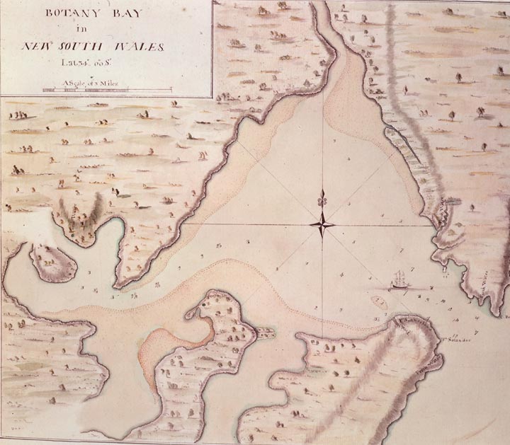
Captain James Cook (1728 – 1779)
was a British explorer, navigator, cartographer, and captain in the Royal Navy. Cook made detailed maps of Newfoundland prior to making three voyages to the Pacific Ocean, during which he achieved the first recorded European contact with the eastern coastline of Australia and the Hawaiian Islands, and the first recorded circumnavigation of New Zealand. During the Seven Years War (1756-1763) Cook went to Canada where he learned how to survey and make charts. http://www.captcook-ne.co.uk/ 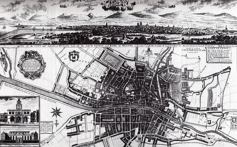
Charles Brooking (1677-1738)
In 1715 Brooking was described as "the painter from Plymouth", he was employed not only for simple work, but also for figure painting and lettering. In 1718, Charles Brooking went bankrupt. The bankruptcy proceedings began in Plymouth, and dragged on until 1722 in the Guildhall, London. It appears that he had settled his debts, and then moved temporarily to Dublin. His map of Dublin was first published in 1728. http://www.cichw1.net/pmyartcraf.html 
Abraham Lincoln statue, New Salem Park, Illinois
Lincoln served as New Salem's postmaster and later became a skilled surveyor working for the county. A life-size bronze statue was erected in New Salem Park, Illinois, of Abraham Lincoln surveying.
The inscription on the base reads, "A. Lincoln - Deputy Surveyor, Sangamon County, Illinois 1833-1837." also, "Unsuspecting as he was in this place, young Lincoln's honesty and fairness as a surveyor, and his knowledge of the land and its people, set him on a journey that led to the Presidency of the United States." EARLY SURVEYING AND MAPPING (U.S.A.)
http://www.amls.ca/early-surveying-mapping |
Timothy Pont (c.1565–1614)
was a Scottish cartographer and topographer, the first to produce a detailed map of Scotland. Pont's maps are among the earliest surviving to show a European country in minute detail, from an actual survey. Pont Maps of Scotland, ca. 1583-1614 http://maps.nls.uk/pont/ 
Detail from map of Wilshire, Christopher Saxton
Christopher Saxton (c.1540 – c.1610)
was an English cartographer who produced the first county maps of England and Wales. http://special.lib.gla.ac.uk/exhibns/month/june2002 William Camden (1551 - 1623)
'Camden's Britannia', first published in 1586, was one of the most popular and influential books of the period. It was a detailed historical and topographical description of Great Britain. Between 1607 and 1637, county maps engraved by William Kip and William Hole, and based largely on Saxton's surveys, were added. Read......... https://ebooks.adelaide.edu.au/c/camden/william/ 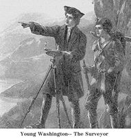
George Washington (1732 - 1799)
George Washington was an avid land surveyor throughout his life. He was naturally suited to the challenges presented by laying lines and charting tracts in the Virginia back country. Over the course of fifty years Washington completed numerous surveys, many documenting the settlement of the territory along Virginia's western frontier, while others laid out the boundaries and agricultural fields of his continually expanding Mount Vernon plantation. http://www.mountvernon.org/digital-encyclo The Mapmaker of Mount Vernon
http://www.earlyamerica.com/early-america-review John Strype (1643 - 1737)
John Strype's ‘A Survey of the Cities of London and Westminster’ contains a large number of illustrations, including important post-Fire maps, which provide a detailed rendering of the capital's parishes and wards. John Strype's- A SURVEY OF THE CITIES OF London and Westminster http://www.hrionline.ac.uk/strype/ PERAMBULATION about the Parishes & Towns adjacent within the Compass of Five Miles of London http://www.hrionline.ac.uk/strype/TransformServlet Irish Historic Towns Atlas Online: Kilkenny
https://www.ria.ie/irish-historic-towns-atlas-online List of cartographers
https://en.wikipedia.org/wiki/List_of_cartographers English surveyors
https://en.wikipedia.org/wiki/Category:English_surv Scottish surveyors https://en.wikipedia.org/wiki/Category:Scottish_surv |
|
Christopher
(1786-1855) and John Greenwood (ca. 1790-1840) were brother cartographers who produced large-scale maps of England and Wales in the 1820s. Their partnership began in 1821, using the imprint "C.& J.Greenwood". |

|
|
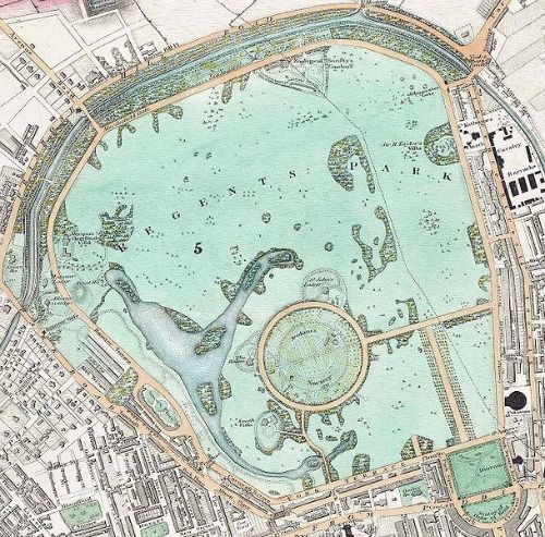
Regent's Park in London by John Nash 1830
English Architect (1752 - 1835) Nash became architect to the Department of Woods and Forests in 1806 and prepared plans for developing Marylebone Park. His scheme provided for the laying out of Regent's Park with villas and surrounding terraces of grand houses and for the creation of a processional thoroughfare (Regent Street) from Marylebone to the seat of government in Whitehall. This gigantic program, known as the Metropolitan Improvements, was a masterpiece of early town planning and transformed London's West End. Encyclopedia.com |
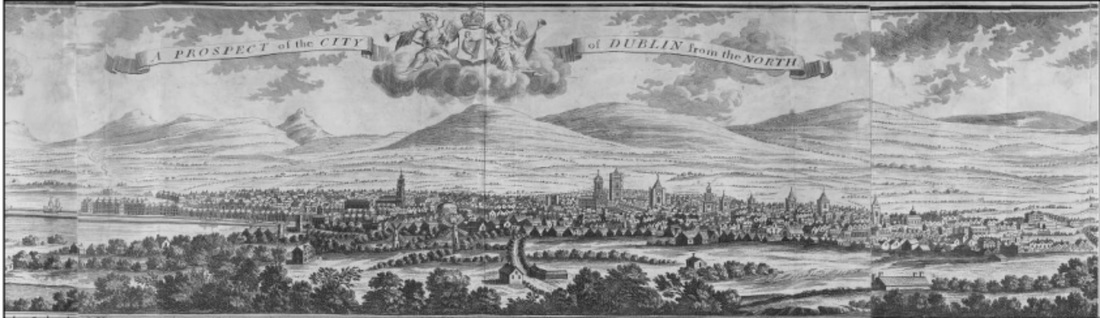
A section of Brooking’s prospect of Dublin looking south
Charles Brooking, A map of the city & suburbs of Dublin 1728
Charles Brooking, A map of the city & suburbs of Dublin 1728
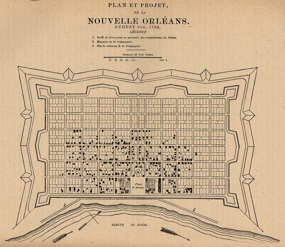
French diagram of New Orleans grid (1763)
|

for larger view.....
https://upload.wikimedia.org/wiki Lists of British, Australian and New Zealand Surveyors-General, Government Geologists, Printers, Ministers, etc
http://www.anzmaps.org/wp-con |
As far back as 1587 Arthur Robins listed some of the ‘extraordinary charges’ that a surveyor can run into:
[Surveyors] ... have commonly the allowance of 10s by the day besides horse meat and man’s meat, travelling charges and all other charges whatsoever, and the servants of the said noblemen or gentlemen with the tenants of their several lordships or manors to attend upon them for measuring. [Regards hiring assistance] I shall be constrained to hire and maintain at great charges for that purposes, unless they be such as will do nothing else but misinform and seek to interrupt and hinder the service …
[Surveyors] ... have commonly the allowance of 10s by the day besides horse meat and man’s meat, travelling charges and all other charges whatsoever, and the servants of the said noblemen or gentlemen with the tenants of their several lordships or manors to attend upon them for measuring. [Regards hiring assistance] I shall be constrained to hire and maintain at great charges for that purposes, unless they be such as will do nothing else but misinform and seek to interrupt and hinder the service …
Equipment
|
The Circumferentor The Circumferentor was in use before the mid-seventeenth century & possibly much earlier. The instrument consisted of a circular box about five or six inches in diameter, which contained a brass circular ring divided into degrees. At the centre of the box was a vertical pin with a magnetically charged needle was placed that naturally pointed to magnetic north. |
|
The Pantometron
The pantometron was another theodolite offshoot that cropped up during the mid-eighteenth century. |
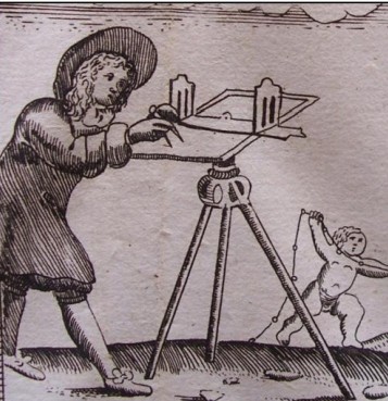
The PlainTable
It's main advantage was its ease of use, especially for amateur or novice surveyors conducting work on small areas of land with minimal detail. However, for the professional, the same processes could be reproduced to a higher degree of accuracy & detail with a circumferentor or theodolite: |
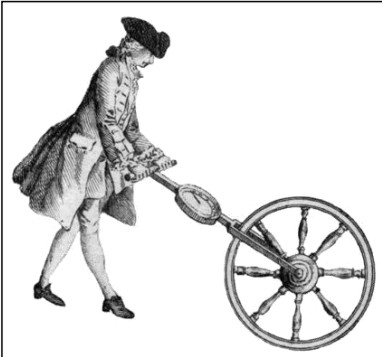
The Perambulator
The perambulator was best suited to low accuracy surveys, such as road distances, for rough terrain could cause the instrument to give inaccurate results due to wheel slippage. It did however provide an easy-to-use replacement for survey chains when the accuracy obtained from chains was not required: The wheel with its indices, showing the distance, and its box & needle with sights showing the bearing or position in respect to the meridian, is an instrument speedy and sufficiently exact |

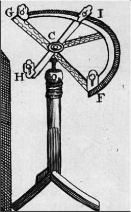
The Theodolite
A Theodolite was used for surveying and a common feature of eighteenth-century theodolites was a horizontal circle measuring approximately twelve inches |
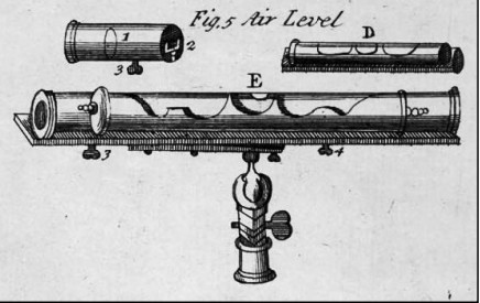
The Air Level
The need for an accurate level became apparent during the industrial revolution as canals and later railways required height data to a high degree of exactness. 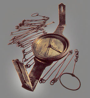
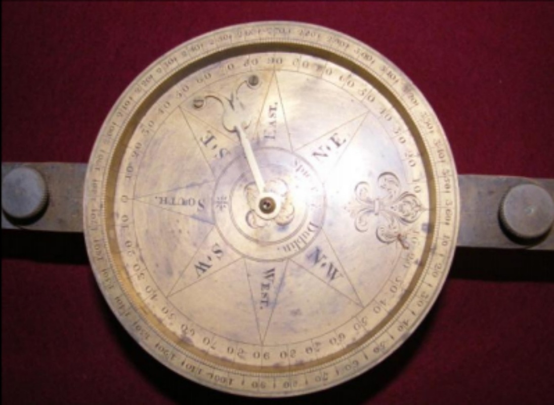
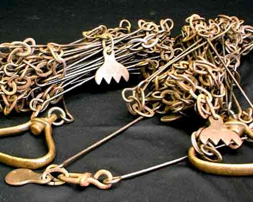
Compass and Chain
The compass determines magnetic direction & the land was measured by the chain and links. |
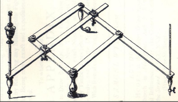
The Pantograph, by Samuel Wyld used by Surveyors
A Pantograph, is a mechanical linkage connected in a manner so that the movement of one pen, in tracing an image, produces identical movements in a 2nd pen Just like the Sketch-a-graph I had when I was a child! 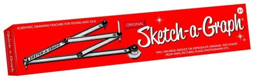
The Sketch-a-graph
A great child's toy in the 1960's & 70's & apparently still available today. INTRO TO ANTIQUE SURVEY INSTRUMENTS
http://www.surveyhistory.org/intro SURVEYING http://www.encyclopedia.com/topic/surveying.aspx |
The rod is useful as a unit of length because whole number multiples of it can equal one acre of square measure.
|
The Gunter Chain
Was originally manufactured in England. 100 links is one Chain and the length was approx. 20 metres. It was used to measure land boundaries in Victoria up until the late 1800’s Land measurement -
7.92 inches =1 link (20.1168 cm) 1 rod, perch, or pole = 25 links = 16.5 ft (5.0292 mtrs) 22 yards =1 chain (20.1168 mtrs) 1 chain = 100 links, or 4 poles ( 66 feet) 10 chains = 1 furlong 220 yards =1 furlong (201.168 mtrs) 8 furlongs = 1 mile 1 acre = 10 square chains http://www.gloverfamily.com/docs/landmeasurements.htm |
Instrument transportation was another practical concern for surveyors. Surveying instruments were the sole means for a surveyor to perform his work so if they were damaged or broken while travelling to the survey site this would have serious ramifications.
|
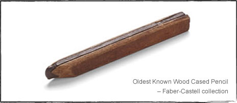
Pencils
1832- First record of a factory in Keswick making pencils. Only graphite pencils were made in the early days and the strip or lead consisted of pure Cumberland graphite. Keswick remained well known for producing the finest pencils in the world.
All Surveyors used pencils. Keswick, Cumberland was the home of pencil making
|
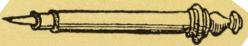
The Common Lead Pencil
The common lead pencil, or leadholder, was vital to any surveyor during the 18th c., as even in fine rain, ink would run. Pencil Makers in Warwickshire
https://books.google.com.au/books?id=lIxJAAAAM Keswick Parish registers
http://dustydocs.com.au/county/7/cumberland.html |
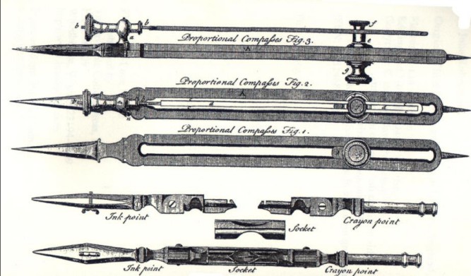
18th century Drawing instruments. London 1775
In the 1850's, William Monroe in the U.S. invented a machine capable of making groves in wooden slats for making pencils.
Pencil History
http://pencils.com/pencil-history/ 
|
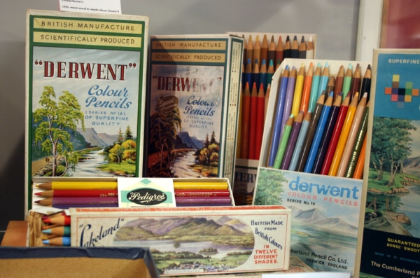
Derwent made 'Lakeland' pencils as well.
|

There is no lead in pencils, the core is made up of non-toxic graphite. The common name “lead pencil” is due to an historic association with the stylus made of lead in ancient Roman times.
|
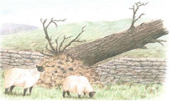
History of Graphite Discovery
Legend has it that in the early 1500’s, a violent storm in the Borrowdale area of Cumberland led to trees being uprooted. Beneath the trees was a strange black material that left its mark on whatever it touched. This material was graphite, a core component of the modern-day pencil. Shepherds began using it to mark their sheep. The roots of the pencil industry were formed. website includes a 13 min. video on 'How Pencils are made' http://pencils.com/derwent-pencil-company-brand-profile/ |
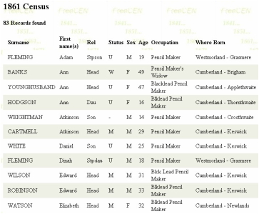
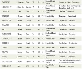
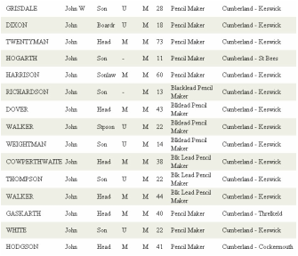
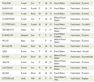
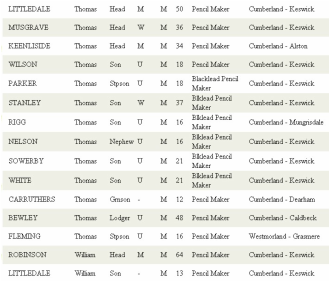
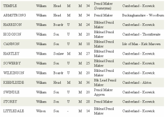
Some Pencil Makers in the 1861 Census
|
|
|
|
|
Freecen.org
http://www.freecen.org.uk/cgi/search.pl |
In 1938, the development of the first set of 24 Derwent coloured pencils was introduced.
Derwent Cumberland Pencil Company
Have been making pencils in Cumbria since 1832. Derwent means, "valley thick with oaks"
Keswick remained well known for producing the finest pencils in the world. Previously the pencils had been made by hand in small workshops, but in 1832, the first pencil factory in the area was opened by Banks, Son & Co. This company would pass through several hands before becoming
the Cumberland Pencil Company in 1916.
https://en.wikipedia.org/wiki/Derwent_Cumberland_Pencil_Company
1974 Pencil & Graphic Instruments Safety regulations -
safety limit set on use of heavy metals in all pencils.
safety limit set on use of heavy metals in all pencils.
|
Hawney’s 'The Complete Measurer'
The sort of mathematics that students were taught can be found in Hawney’s 'The complete measurer'. Hawney, in this case, took artistic liberty with his question, but it's a clever example of ratio/scale calculation: A Maypole there was, whose height I would know, The sun shining clear, strait to work I did go. The length of the shadow, upon level ground, Just sixty-five feet, when measured I found. A staff I had there, just five feet in length, The length of its shadow was four feet one tenth. How high was the Maypole, I gladly would know and it is the thing you’re desired to show. https://archive.org/details/hawneyscompletem00hawnrich |
How High is the Maypole?

|
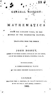
A general history of mathematics from the earliest times to the middle of the eighteenth century by Charles Bossut 1730-1814 &
John Bonnycastle c.1750-1821 https://archive.org/details/generalhistoryof00bossrich |
An example of a mathematical problem relevant to the British Navy
And contained in a widely-distributed mathematics text of the eighteenth century, is given in the example below: Suppose a crew of fifty four English Sailors were to attack a French fort, and carry off six pieces of brass cannon weighing one with another 980 lb French: How much would each John’s share come to, supposing they could fell the cannon at 8l. a hundred weight English? |
|
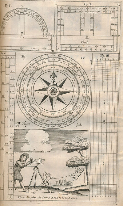
William Leybourn (1626–1716) was an English mathematician and land surveyor. Planometria, or, The Whole Art of Surveying of Land was a pamphlet written in 1650 by Leybourn, who expanded this into a full book, The Compleat Surveyor which was first published in 1653, by his own press. The book outlined the various instruments used in surveying, and how they were employed and was one of the standard references in the field for the remainder of the 17th century and into the 18th century. The book instructed property surveyors on the construction of property maps, and how to make the appropriate coloured inks for the maps.
The Book is now worthy a tidy sum 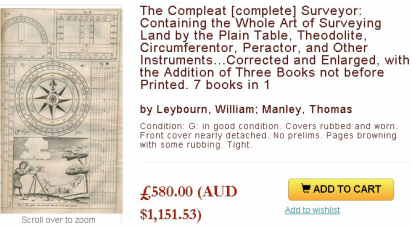
|
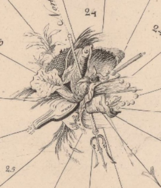
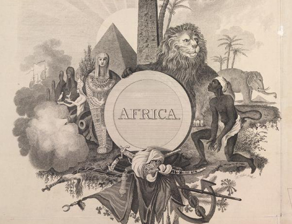
Cartouches
J.Rocque 1757
Cartouches are non-geographic, decorative or ornate features containing a map’s title, its dedication, its authors name and occasionally its scale bar.

Elaborate north arrow. Thomas Sherrard, Athlone (1784)
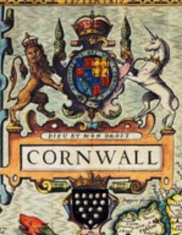
Cornwall by John Speed
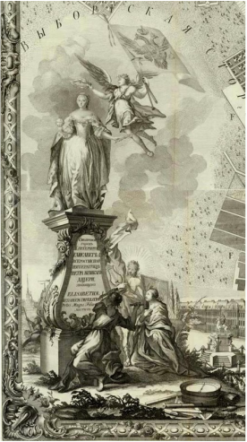
Cartouche from the Plan of St. Petersburg 1753
|
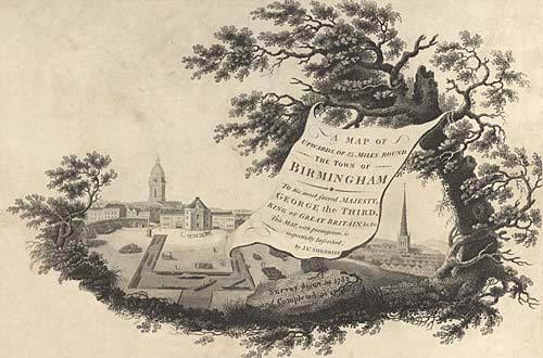
Cartouche showing canals and churches from map of area around Birmingham, 1798
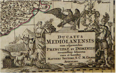
1730 SEUTTER (Allard) Map NORTHERN ITALY
Cartouche from Rocque's Map of Dublin
Cartouche from Arrowsmith Map 1820
|
|
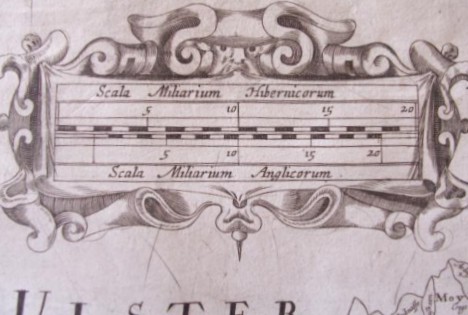
Scale bar with Irish (top) & English (bottom) measurement systems
William Petty Hiberniae Delineato London 1685 |
Australian Cartography
& Maps
& Maps

Survey of Settlement at Port Jackson, in New South Wales
From the actual survey, 1789-1791 & produced by engraver to the Admiralty, John Walker.
All about it
http://www.sl.nsw.gov.au/discover_collections/history_nation/terra_australis/charts_maps/walker/index.html
Walker's map names the mountains to the west the Caermarthen Mountains (later Blue Mountains).
A bigger map at this site below
http://www.nla.gov.au/apps/cdview/?pi=nla.map-rm720-sd&rgn=0.4993984469,0.
|
Personal Maps
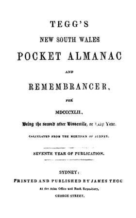
The nineteenth century saw the rise of maps for personal use, such as this one from the Tegg's N.S.W. Pocket Almanac & Remembrancer 1837, a directory of city services.
Prest's Social Survey of Melbourne employed Sands & MacDougall's 1942 directory to draw a sample of households for investigation. The first sophisticated historical use of Australian directories, appears to have been by Graeme Davison in his research for The rise and fall of Marvellous Melbourne (1978). About Prest's Social Survey of Melbourne http://archives.unimelb.edu.au/__data/assets/pdf_file/0006/12 Graeme Davison (Marvellous Melb.) http://www.unimelb.edu.au/unisec/calendar/honcausa/citati Search N.S.W. Almanacs on Find My Past
http://www.findmypast.com.au/articles/world-records/full-list- |
|
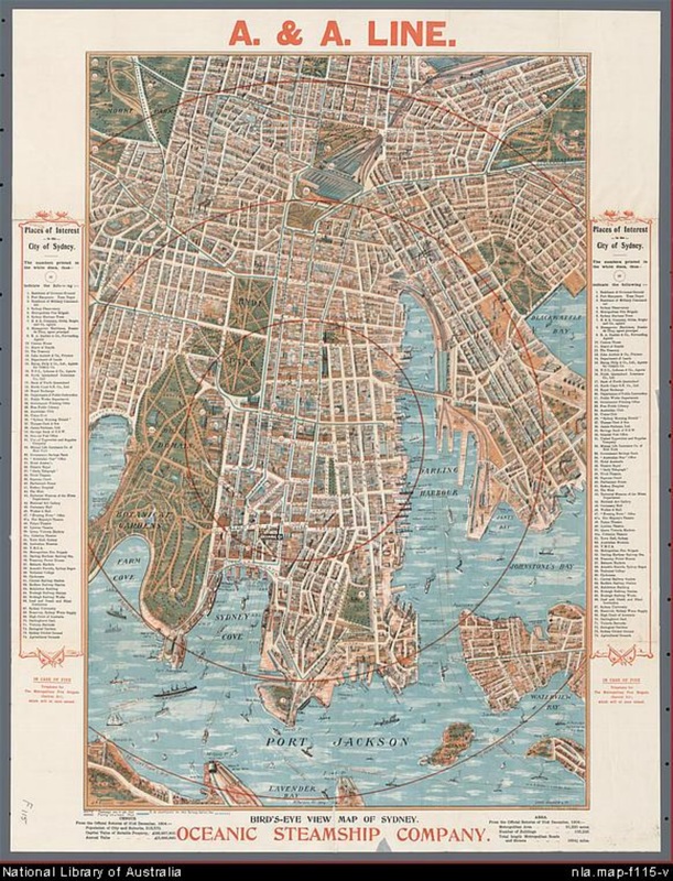
Maps were Produced as Souvenirs
Also for visitors. Maps such as this comprehensive 1905 map produced by the Oceanic Steamship Company, which shows the layout of the city, civic buildings, theatres, hotels, important places like the United Typewriter & Supplies Company, Arnott's Biscuits, Sydney Depot and the Cyclorama. see zoomable map...... http://www.nla.gov.au/apps/cdview/?pi=nla.map-f115 
A Short History of Sydney Cartography
https://mirrorsydney.wordpress.com/2013/06/19/a-short |
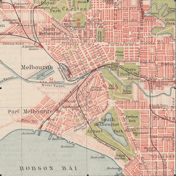
The Central Melbourne Map from the 1912 edition of "Moulton's Street Directory"
That shows the location of the "Central Railway Station".
http://tdu.to/a42021/Melbourne_1912.jpg
That shows the location of the "Central Railway Station".
http://tdu.to/a42021/Melbourne_1912.jpg
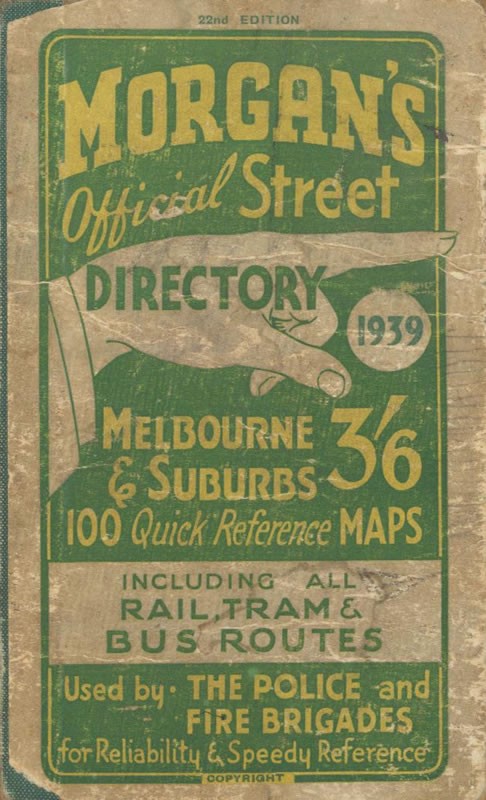
Moulton's Directory
of Streets for Melbourne & Suburbs, which appeared from 1911 to 1912, was taken over by the advertising agent Val Morgan in 1916 as Morgan's (late Moulton's) and published simply as Morgan's Street Directory from 1918. 
Val Morgan (1876-1952), publicist, was born probably in Albert Park, Melbourne. As 'Val Morgan Advertising Contractor' he had begun operations in Melbourne in 1894. For several decades he held the contract for advertising all the social events of the Victoria Police, such as their football and athletics clubs, and their brass band.In 1914 Morgan began to produce and distribute cinema advertising slides, and from 1921 moving picture films for advertising on cinema screens. In 1916 he purchased the business that issued Moulton's Street Directory. The publication became Morgan's Street Directory and ran to more than fifty issues up to the late 1970's. Morgan, established two interrelated companies: Radio 3KZ Broadcasting and 3KZ Advertising.
Morgan died in 1952 & is buried at the St. Kilda Cemetery. In 1987, when the enterprise was under the direction of the founder's grandson Valentine Charles Morgan, the family sold its interest in the firm, which continues to provide cinema advertisements in Australia and overseas. Search- MELBOURNE DIRECTORY 1854-1893
on Find My Past http://www.findmypast.com.au/articles/world-record PENRYN Universal Business Directory of 1791. PENRYN is an ancient borough in the hundred of Kirrier, in the county of Cornwall
http://penryncornwall.com/universal_1791.htm 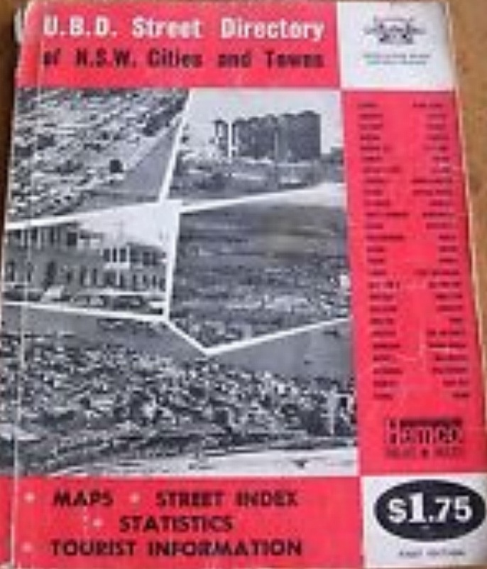
Universal Business Directories (UBD) published their first Universal Street Directory in 1955.
Gregory's eventually amalgamated with UBD and now Hardie Grant has just acquired Universal Publishers, Australia’s leading publisher of street directories. All of their products are produced and marketed nationally under Australia’s most trusted and recognisable brands – Gregory’s and UBD. http://www.emelbourne.net.au/biogs/EM00470b.htm 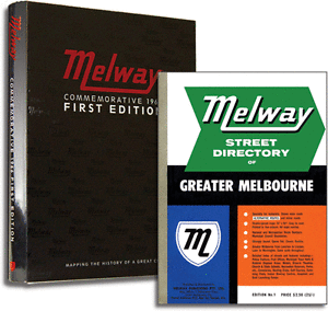
Melway Commemorative 1966 1st Edition $149.00
http://www.melway.com.au/melway-common Real up to date usable
Street Directory online If You prefer to see the streets on the map, like a real street directory and not the GPS, then check out this site............. http://www.street-directory.com.au/vic/ |
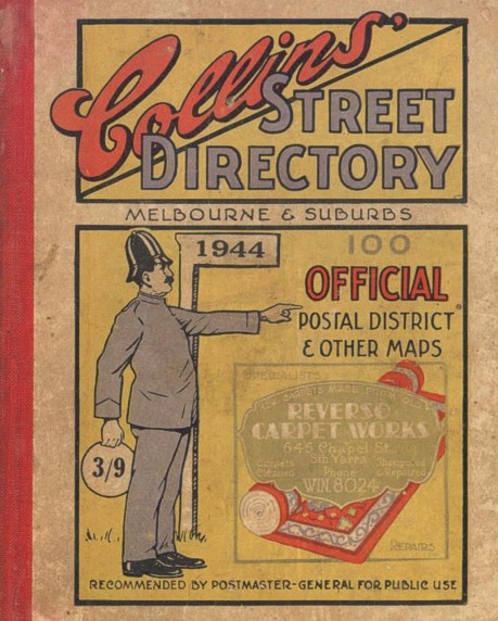
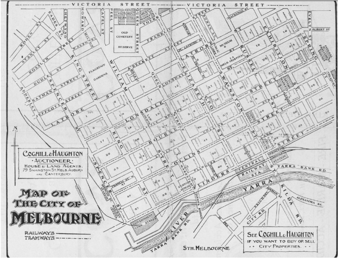
Collins' Melbourne and
suburban street directory Author/Creator Walter J Moulton, as in Moulton's Street Directory. The first edition was in 1922 and it ran until 1952. Apart from a great deal of advertisements, it also has name listings of Chemists, real Estate Agents, Builders, Furniture salesmen, Justice of the Peace etc., which may be of some use to Family Historians? Both Morgan's & Collins' Directories, can be viewed online, from the State Library Victoria website. http://cedric.slv.vic.gov.au/R/75UMIQX7P
Bathurst journalist
Cecil Albert Gregory, in 1934 After he came to Sydney to work and had trouble finding his way about, founded his directory. Gregory's began as pocket book guides organised suburb by suburb whose simple maps were accompanied by descriptive lists of streets. They later went on to produce motor car repair manuals. http://www.drive.com.au/it-pro/gregorys-relegated 1934 – Gregory’s Sydney Directory voomMAPS has scanned the maps from the first edition of Gregory’s Sydney street directory published in 1934. Click on the page numbers on the index map below to view the maps. http://voommaps.com/historical-maps/1934-gregorys 
Automobile Manuals Online
http://auto.manualsonline.com/manuals/device/auto 
Melway History
Merv Godfrey OAM 27th Feb. 1924 ~ 29th March 2013, was the originating designer & cartographer of the Melway Street Directory. Training as a survey draughtsman with the Victorian Lands Department, he also served with the RAAF as a radio operator during WW2. Following the war, he was employed with the SEC Vic. & became involved with various tourist maps during his spare time. http://www.melway.com.au/melway-history |

Access early Melways Maps online. See what your area was like in 1966
Map Search
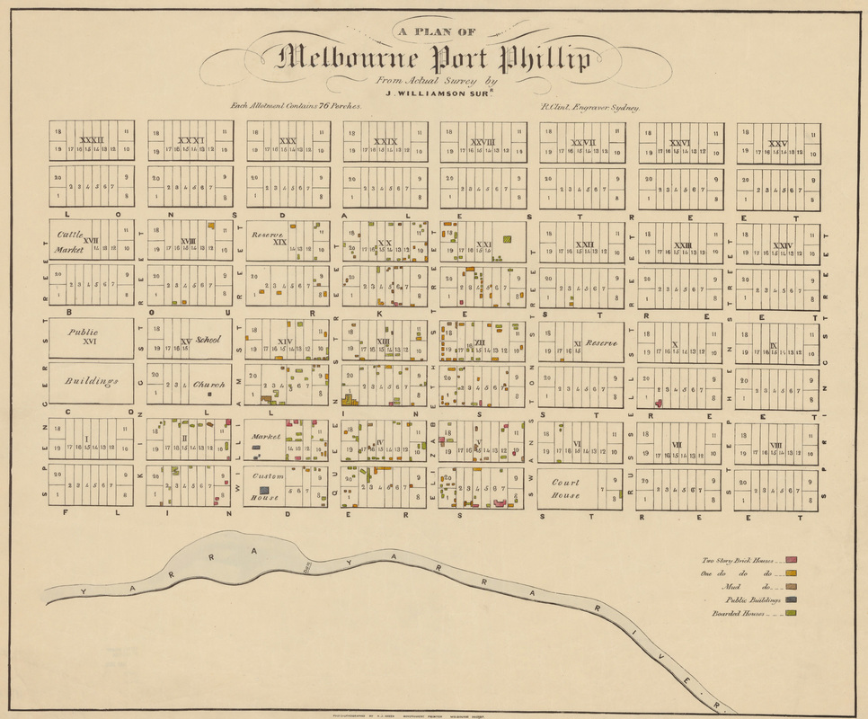
Plan of Melbourne Port Phillip.
to zoom in...........
http://ergo.slv.vic.gov.au/sites/default/files/imagecache/download/vc000242-001.jpg
to zoom in...........
http://ergo.slv.vic.gov.au/sites/default/files/imagecache/download/vc000242-001.jpg

London street views 1840
http://crowd.museumoflo |
Place and Map Search 1674 to 1834
This website allows you to search a wide body of digital resources relating to early modern and eighteenth-century London and to map the results on to a fully GIS compliant version of John Rocque's 1746 map. http://www.oldbaileyonline.org/forms/formMaps.jsp
Charles Booth's massive survey of London
at the close of the nineteenth century focused on life and labour in London http://booth.lse.ac.uk/ |
University of Texas- Historical Map Web Site Links- Worldwide
http://www.lib.utexas.edu/maps A Historical Atlas and Gazetteer of Europe from Year 1 to 2000
http://www.euratlas.net/history/ |
Historic Cities (maps)
This site contains maps, literature, documents, books and other relevant material concerning the past, present and future of historic cities around the world and facilitates the location of similar content on the web. http://historic-cities.huji.ac.il/search_a_z.html |
|
Cartographic Collection- New Zealand, the Pacific and Antarctica.
https://natlib.govt.nz/collections/a-z/cartographic-collection |
|
|

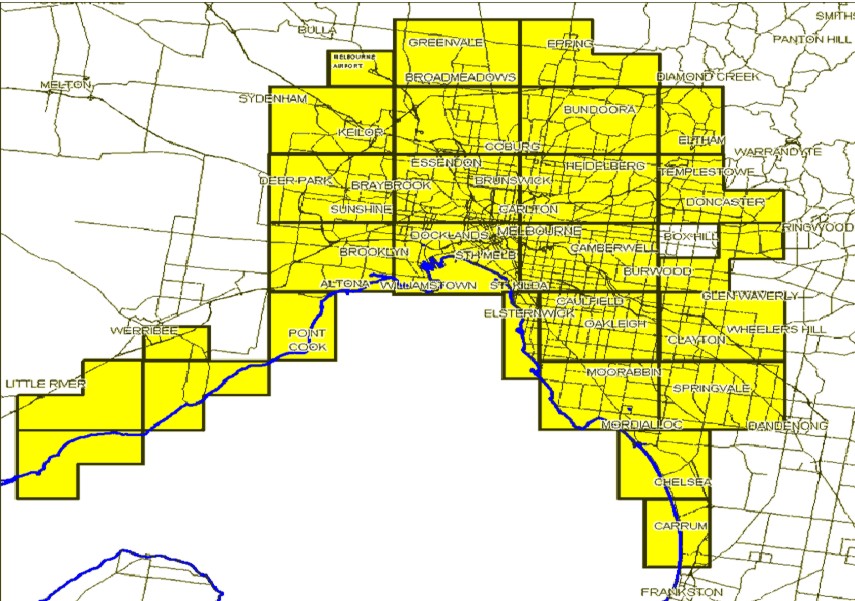
State Library Victoria- Suburban Melbourne
http://guides.slv.vic.gov State Library Victoria- Auction Plans http://www.slv.vic.gov.au 
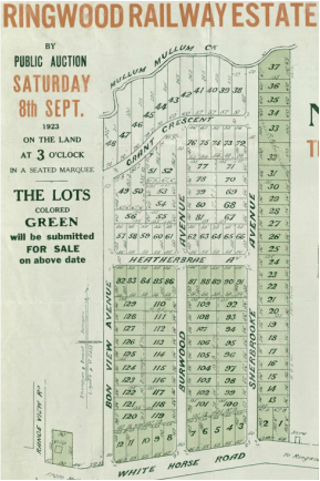
Boxhill, Victoria 1880's Allotments with names
Boxhill, Victoria 1880's, from Herald Sun, How far we've come Names marked on allotments, go to website for closer view. |
Map Collections, University of Melbourne
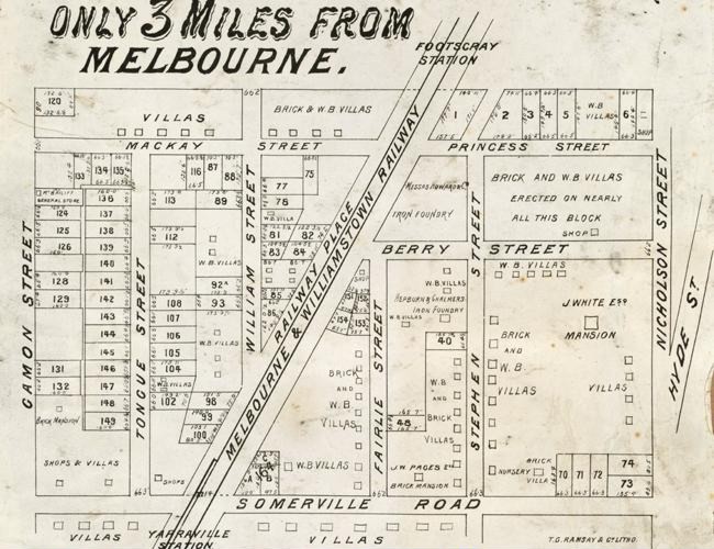
http://library.unimelb.edu.au/digitalcollections/cultural_and_special_collection Footscray, Victoria 1880's, from Herald Sun, How far we've come
Glenroy, Victoria 1880's, from State Library Victoria

|
|
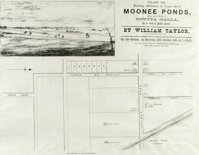
Moonee Ponds, Victoria 1880's, from Herald Sun, How far we've come
|
Auburn, Victoria, from State Library Victoria

|

Huguenots
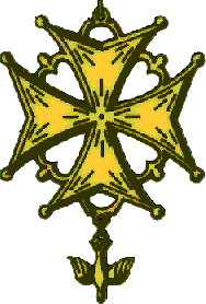
Huguenot Official Symbol
Who Were the Huguenots?
The Huguenots were French Protestants most of whom eventually came to follow the teachings of John Calvin, and who, due to religious persecution, were forced to flee France to other countries in the sixteenth and seventeenth centuries. Some remained, practicing their Faith in secret.
http://www.huguenot.netnation.com/general/huguenot.htm
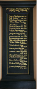
List of American Presidents of Huguenot descent, inside the French Protestant (Huguenot) Church in Charleston, SC
The National Huguenot Society, maintains that eight U.S. Presidents can definitely be traced as Huguenot descendants. They are: George Washington, Ulysses S. Grant, Theodore Roosevelt, William Howard Taft, Franklin D. Roosevelt, Harry S. Truman, Gerald Ford, Lyndon B. Johnson
Huguenot Surnames
Just a Few- Adrian, Boyer, Cordner/Cordiner, Delport, Emery, Fletcher, Gilbert, Hamon, Jacobs, Le Page, Marion, Portal, Robins, St John, Violet, Wood http://www.huguenotsaustralia.org.au/nam Huguenot Street- List of Genealogy Collections
http://www.huguenotstreet.org/list-of 
|
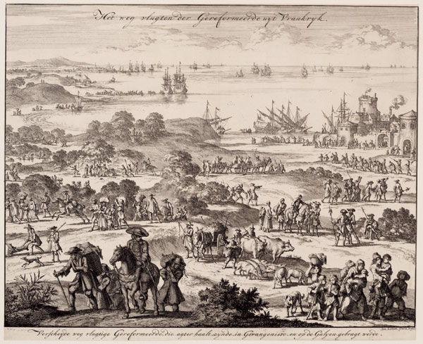
Huguenots fleeing France. Engraving by Jan Luyken, 1696.
Huguenots: Flight from France
Late in the 17th century, France declined from being the most powerful and rich nation in Europe to a country pressed to hold its own against powerful foes. One event helps explains this decline. On October 18, 1685, King Louis XIV revoked the Edict of Nantes. In doing so, he drove hundreds of thousands of his best citizens abroad. The Edict of Nantes was a promise of religious toleration. It was granted in 1598 to the French Protestants known as Huguenots after years of civil wars. The Roman Catholic church was concerned at its loss of control over souls; the government feared Protestant demands for local rule. War began in 1562 when a number of Huguenots were massacred by the Guises in a church at Vassy. read more............... http://www.christianity.com/church/church-history/timeline 
Guise, François de Lorraine, duc de: assassination. Huguenot assassin taking aim at François de Lorraine, 2e duc de Guise, 1563. (Hulton Archive/Getty Images)
http://www.britannica.com/topic/Huguenot |

The massacre, with the murder of Gaspard de Coligny above left, as depicted in a fresco by Giorgio Vasari.
Tracing Huguenot heritage http://www.slq.qld.gov.a Family History, Huguenot Society http://www.huguenotsoc |
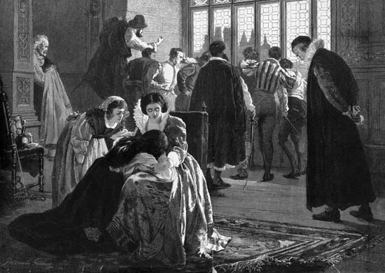
Saint Bartholomew’s Day, Massacre of French Huguenots grieving after the Massacre of St. Bartholomew’s Day (August 24–25, 1572), in which thousands of Huguenots were killed by French Catholic forces. (Hulton Archive/Getty Images)
St. Bartholomew's Day Massacre
In 1572 was a targeted group of assassinations and a wave of Catholic mob violence, directed against the Huguenots (French Calvinist Protestants) during the French Wars of Religion. Traditionally believed to have been instigated by Catherine de' Medici, the mother of King Charles IX, the massacre took place five days after the wedding of the king's sister Margaret to the Protestant Henry III of Navarre (the future Henry IV of France). This marriage was an occasion for which many of the most wealthy and prominent Huguenots had gathered in largely Catholic Paris. The massacre began in the night of 23–24 August 1572 (the eve of the feast of Bartholomew the Apostle), two days after the attempted assassination of Admiral Gaspard de Coligny, the military and political leader of the Huguenots. The king ordered the killing of a group of Huguenot leaders, including Coligny, and the slaughter spread throughout Paris. Lasting several weeks, the massacre expanded outward to other urban centres and the countryside. Modern estimates for the number of dead across France vary widely, from 5,000 to 30,000. (wiki) https://en.wikipedia.org/wiki/St._Bartholomew%27s_Day_massacre 
Huguenot Genealogy
http://www.olivetreegenealogy.com/hug/ Huguenot Records and Registers (Nonconformist) http://www.genguide.co.uk/source/huguenot-records-and-registers- |